My memories were so weak, and my previous pictures were so lame that I had to go back to Himalaya for a refresh. I even made the same trail – Lukla to EBC – but I added an extension: I went to Gokyo Ri by Cho La pass (sorry for the pleonasm, “La” means in fact “pass”). My conclusion: EBC is overrated. I don’t mean you should ignore it: as a mountain lover you should have EBC on the bucket list; but the real perception of the Everest citadel in the middle of Sagarmatha wonder can be better achieved from other lucky spots. And Gokyo Ri peak is one of the best places for that (sorry again for the pleonasm, “Ri” means “peak”).
Everest cannot be seen from EBC. You must go upper a few hundred meters on Kala Patthar to see the top of the world appearing in a strange perspective, dominated by Nuptse who steals the show. Or, if you’re a real climber go on Pumo Ri, but this is out of the question for tourists like me.

Gokyo is at 25 km away from Everest, but the view is magnificent, and you can spot four eight–thousanders at a glance. Gokyo is a very pleasant settlement, a piece of Switzerland in the middle of Himalaya (it has also two lovely bakeries). The hill in the left is Gokyo Ri but don’t rush, there are almost five hundred meters elevation to the top (5360 meters).

Obviously, the best moment of the day to be on Gokyo Ri for photos would be in the afternoon or evening having the sun behind. But, during my entire trek at the end of April, the weather pattern was almost the same everyday: clear sky during night and early morning, with clouds forming before afternoon and bigger clouds covering all the peaks in last part of the day. You should be lucky to have clear sky over the mountains in the afternoon or maybe this happens in other months. I had to go up in the early morning with an adverse light and the sun scratching my lens.
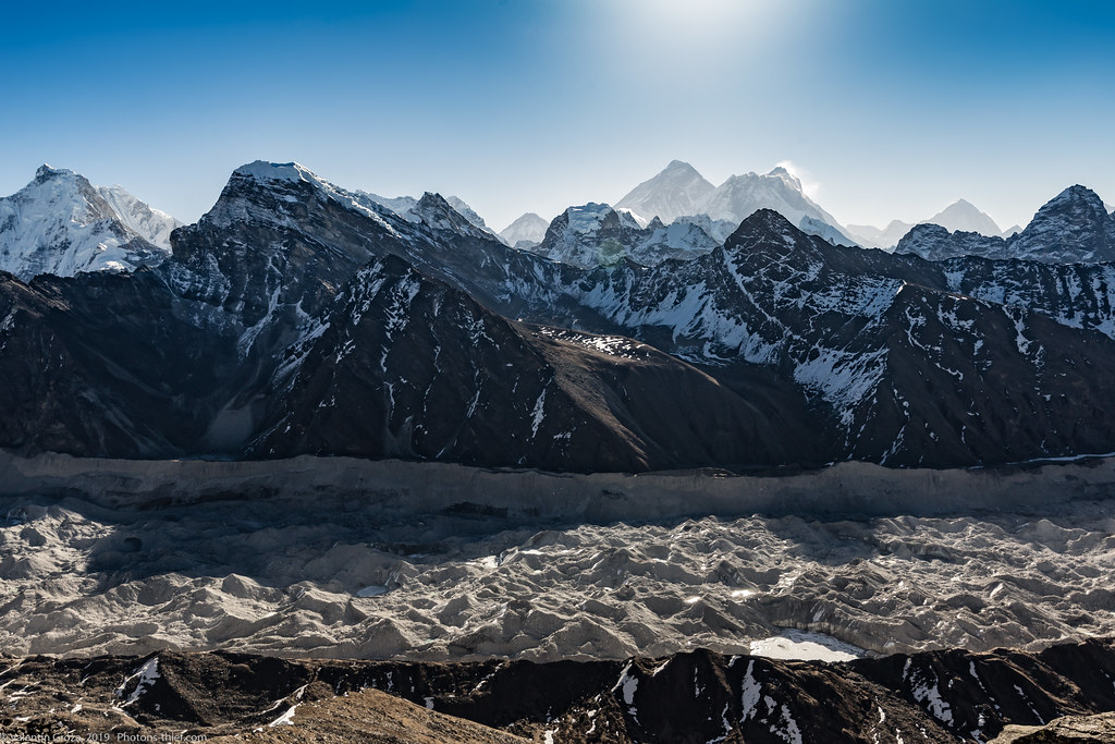
This is the panorama beyond the Ngozumpa Glacier, the longest glacier in the Himalayas.

I am going to take a closer look to each peak, for better details, from left to right.
The giant on the left is Cho Oyu (8188 meters), the sixth-highest mountain in the world.

On the same ridge to the right is Ngojumba Kang also named Tenzing Peak (7916 meters). This ridge is also the border between Nepal and China as far as you can see, to Makalu.

Further on the same ridge there is a giant trapezoid, Gyachung Kang (7952 m). It is the fifteenth-highest peak in the world, and the highest seven-thousander. In other words, this is the first mountain coming after the world’s top of 14 eight-thousanders.

Hungchhi Peak (7036 m)

Cholo (6089 m) and Khangjung (6063 m) with Nirekha (6159 m) in the right.

Then there are several peaks close to each another, Changtse (7543 m) far away in Tibet, at the shoulder of Everest, Lobuche West (6145 m) and East (6119 m) under Everest.
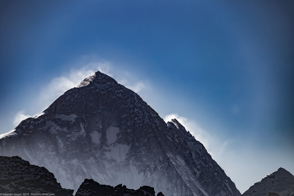
The citadel Everest, Nuptse (7861 m), Lhotse (8513 m) the fourth highest mountain in the world.
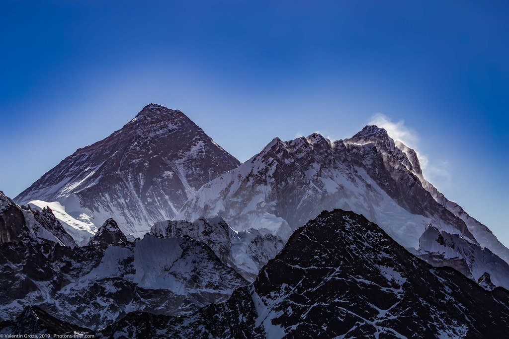
Very far away, Makalu (8485 m) the fifth highest mountain in the world.
Going more to the right you can see in the foreplan the huge molar with 3 crowns: Arakam Tse (6423 m), Tobuche (6367 m) and Cholatse (6335 m).

And the last group to the right: Kangtega (6685 m), Tamserku (6608 m), Kyashar (6770 m) and Kusum Khangkaru (6387 m).


3 gânduri despre &8222;Gokyo Ri beats EBC&8221;